Difference between revisions of "User:U38088265/Ground forces maps"
| Line 41: | Line 41: | ||
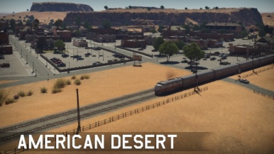
Located in Arizona, USA; American Desert consists of a quiet village in the American desert. With a roundabout at the centre, the train station to one flank, and the other flank representing the outskirts of the village. | Located in Arizona, USA; American Desert consists of a quiet village in the American desert. With a roundabout at the centre, the train station to one flank, and the other flank representing the outskirts of the village. | ||
| + | }} | ||
| + | {{Family-card | ||
| + | |title= | ||
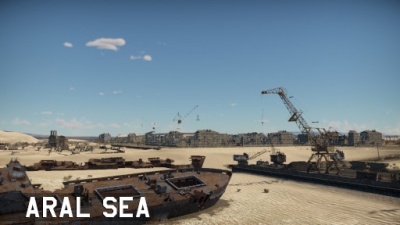
| + | |img=File:MapIcon_Ground_AralSea.jpg | ||
| + | |wiki= | ||
| + | |text= ===[[File:CountryIcon SUN.png|link=|sub]] Aral Sea=== | ||
}} | }} | ||
{{Family-card | {{Family-card | ||
| Line 61: | Line 67: | ||
Located in Ireland; this cliff-filled coast consists of 3 different types of environment: the mountainous west, the plain centre, and the cliffs to the east. | Located in Ireland; this cliff-filled coast consists of 3 different types of environment: the mountainous west, the plain centre, and the cliffs to the east. | ||
| − | |||
| − | |||
| − | |||
| − | |||
| − | |||
| − | |||
| − | |||
| − | |||
| − | |||
| − | |||
}} | }} | ||
{{Family-card | {{Family-card | ||
| Line 81: | Line 77: | ||
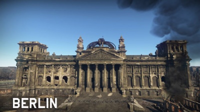
Located in Berlin, Germany; Berlin takes inspiration from the 1945 Battle for the Reichstag, or the Battle of Berlin. At the centre one can find cover alongside a shallow river, to the west side one can fight over the ruins of the urban environment that once surrounded the Kroll Opera House, while at the east of the river one can find the imponent Reichstag which provides limited cover from the open field surrounding it. Further east one can find the Brandenburg Gate. | Located in Berlin, Germany; Berlin takes inspiration from the 1945 Battle for the Reichstag, or the Battle of Berlin. At the centre one can find cover alongside a shallow river, to the west side one can fight over the ruins of the urban environment that once surrounded the Kroll Opera House, while at the east of the river one can find the imponent Reichstag which provides limited cover from the open field surrounding it. Further east one can find the Brandenburg Gate. | ||
| + | }} | ||
| + | {{Family-card | ||
| + | |title= | ||
| + | |img=File:MapIcon_Ground_Breslau.jpg | ||
| + | |wiki= | ||
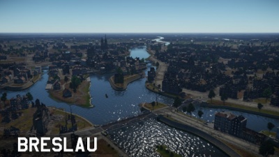
| + | |text= ===[[File:CountryIcon POL.png|link=|sub]] Breslau=== | ||
}} | }} | ||
{{Family-card | {{Family-card | ||
| Line 111: | Line 113: | ||
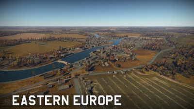
Located in Ukraine; Eastern Europe consists of a river-side city surrounded by hills. To the south one can find forested areas, while to the north one can find the hills surrounding. | Located in Ukraine; Eastern Europe consists of a river-side city surrounded by hills. To the south one can find forested areas, while to the north one can find the hills surrounding. | ||
| + | }} | ||
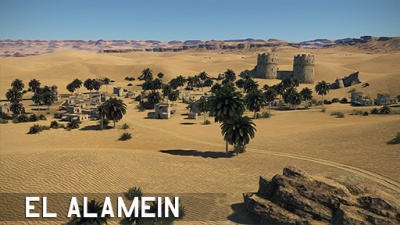
| + | {{Family-card | ||
| + | |title= | ||
| + | |img=File:MapIcon_Ground_ElAlamein.jpg | ||
| + | |wiki=Second_battle_of_El_Alamein_(Ground_Forces) | ||
| + | |text= ===[[File:CountryIcon GBR.png|link=|sub]] Second Battle of El Alamein=== | ||
| + | |||
| + | ''Location: El Alamein, Egypt'' | ||
| + | |||
| + | Located in El Alamein, Egypt; the map can be divided into three sections: to the north, the remains of a fort overlooked by cliffs located further north, a small village a top a hill in the middle, and the desert area filled with dunes to the south. | ||
}} | }} | ||
{{Family-card | {{Family-card | ||
| Line 151: | Line 163: | ||
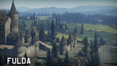
Located in Rasdorf, Germany; Fulda Gap takes inspiration from its real-life counterpart, named after the town of Fulda. The map consists of an elevated centre with forested and hilly areas while the flanks are made up of large open fields while between the southeast and central area one can find a small castle. | Located in Rasdorf, Germany; Fulda Gap takes inspiration from its real-life counterpart, named after the town of Fulda. The map consists of an elevated centre with forested and hilly areas while the flanks are made up of large open fields while between the southeast and central area one can find a small castle. | ||
| + | }} | ||
| + | {{Family-card | ||
| + | |title= | ||
| + | |img=File:MapIcon_Ground_HurtgenForest.jpg | ||
| + | |wiki=Battle_of_Hurtgen_Forest_(Ground_Forces) | ||
| + | |text= ===[[File:CountryIcon NDE.png|link=|sub]] Battle of Hürtgen Forest=== | ||
| + | |||
| + | ''Location: Vossenack, Germany'' | ||
| + | |||
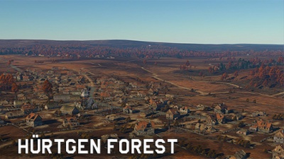
| + | Located in Vossenack, Germany; Battle of Hürtgen Forest takes inspiration from its 1944 real-life counterpart. Located 5 km east of the border with Belgium, the map consists of a town at its core. To the north one can find a forested hill while to the south a shallow river stream surrounded by forested hills is located. | ||
}} | }} | ||
{{Family-card | {{Family-card | ||
| Line 303: | Line 325: | ||
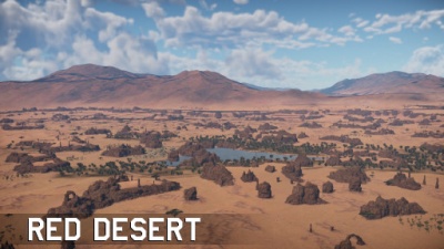
{{Family-card | {{Family-card | ||
|title= | |title= | ||
| − | |img=File: | + | |img=File:MapIcon_Ground_RedDesert.jpg |
| − | |wiki= | + | |wiki= |
| − | |text= ===[[File:CountryIcon | + | |text= ===Red Desert=== |
| − | + | }} | |
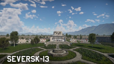
| − | + | {{Family-card | |
| − | + | |title= | |
| − | + | |img=File:MapIcon_Ground_Seversk-13.jpg | |
| + | |wiki= | ||
| + | |text= ===[[File:CountryIcon SUN.png|link=|sub]] Seversk-13=== | ||
}} | }} | ||
{{Family-card | {{Family-card | ||
| Line 330: | Line 354: | ||
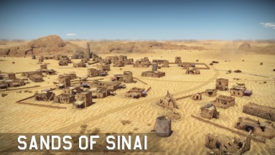
Located in the Southeast of Suez, Egypt; the map consists of the western part of the region. To the far east the same abandoned oil facility, as well as the path in Sinai, are located. The latter overlooking a large village in the eastern part of the map. In the middle, one can find a number of mountains which partition the map between east and west. Westward one can find the desert area where a number of dunes provide cover for advancing units. | Located in the Southeast of Suez, Egypt; the map consists of the western part of the region. To the far east the same abandoned oil facility, as well as the path in Sinai, are located. The latter overlooking a large village in the eastern part of the map. In the middle, one can find a number of mountains which partition the map between east and west. Westward one can find the desert area where a number of dunes provide cover for advancing units. | ||
| + | }} | ||
| + | {{Family-card | ||
| + | |title= | ||
| + | |img=File:MapIcon_Ground_Spaceport.jpg | ||
| + | |wiki= | ||
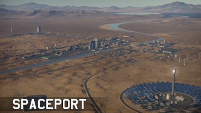
| + | |text= ===[[File:CountryIcon SUN.png|link=|sub]] Spaceport=== | ||
}} | }} | ||
{{Family-card | {{Family-card | ||
| Line 339: | Line 369: | ||
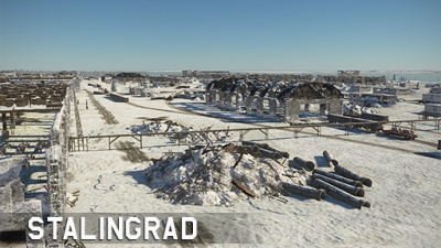
''Location: Stalingrad, Russia'' | ''Location: Stalingrad, Russia'' | ||
Located in Stalingrad, nowadays known as Volgograd, Russia; the map is inspired on the famous World War II Battle of Stalingrad. The north-west area consists of factory complexes which have been damaged and provide places for units to hide. In the middle of the map, one can find the railway stations, further east, one can find a number of ruined apartment complexes as well as an oil complex, which is overlooked by a couple of hills further south. Further lake the frozen river provides concealed passage. | Located in Stalingrad, nowadays known as Volgograd, Russia; the map is inspired on the famous World War II Battle of Stalingrad. The north-west area consists of factory complexes which have been damaged and provide places for units to hide. In the middle of the map, one can find the railway stations, further east, one can find a number of ruined apartment complexes as well as an oil complex, which is overlooked by a couple of hills further south. Further lake the frozen river provides concealed passage. | ||
| + | }} | ||
| + | {{Family-card | ||
| + | |title= | ||
| + | |img=File:MapIcon_Ground_Sweden.jpg | ||
| + | |wiki=Sweden_(Ground_Forces) | ||
| + | |text= ===[[File:CountryIcon SWE.png|link=|sub]] Sweden=== | ||
| + | |||
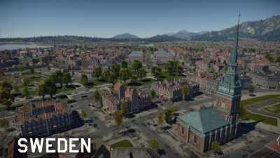
| + | ''Location: Stockholm, Sweden'' | ||
| + | |||
| + | Located in Stockholm, Sweden; the map consists of a long promenade to the borders of the riverbank, westwards of the promenade there are some open parks and most notably an open area of raised land with a government-looking building and monument on it. The middle area consists of large open gardens with four large government buildings in the centre and a courtyard between them. Meanwhile, the west of the map is a largely residential area with an industrial complex with large factory buildings and storage tanks. | ||
}} | }} | ||
{{Family-card | {{Family-card | ||
| Line 389: | Line 429: | ||
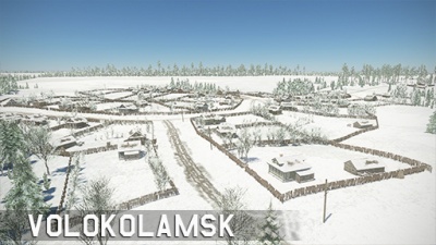
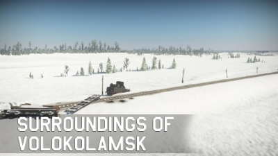
Located in Volokolamsk, Russia; the map consists of the entirety of the Volokolamsk map, making it significantly larger. | Located in Volokolamsk, Russia; the map consists of the entirety of the Volokolamsk map, making it significantly larger. | ||
| − | |||
| − | |||
| − | |||
| − | |||
| − | |||
| − | |||
| − | |||
| − | |||
| − | |||
| − | |||
}} | }} | ||
{{Family-card | {{Family-card | ||
Revision as of 18:30, 10 April 2022
|
|
|
|
|
|
|
|
|
|
|
|
|
|
|
|
|
|
|
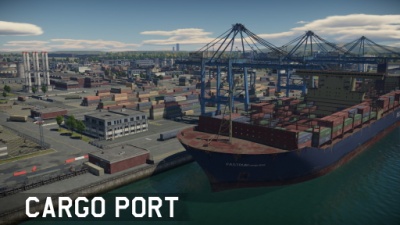
Cargo PortLocation: Fictional Cargo Port is a fictional environment based around a shipment facility. To the north one can find an airfield cut by the long highway. The middle is dominated by buildings while to the south one can find longways separated by containers. |
|
|
|
|
|
|
|
|
|
|
|
|
|
|
|
|
|
|
|
|
|
|
|
|
|
|
|
|
|
|
|
|
|
|
|
|
|
|
|
|
|
|
|
|
|
|
|
Red Desert |
|
|
|
|
|
|
|
|
|
|
|
|
|
|
|
|
|
|
|
|
|
|
|
|
|
|
