Tunisia
| Game Modes | ||||
|---|---|---|---|---|
Contents
Overview
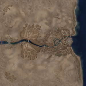
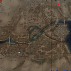
Tunisia is a ground forces map is a ground forces map available in all modes. It was added alongside the British Tanks, and another North African campaign based map Second Battle of El Alamein, in update Update 1.55 "Royal Armour". The map has three distinct battle areas (in AB & RB), the large town in the east, the open military camp in the middle, and valley in the west. A river runs through the map, starting in the west and ending at the sea in in the East.
In the east of the map the river running through the map splits, creating an island, on which there is a large town. Access to the town is usually via two main bridges (one in the north and one in the south) which lead straight into the town. There are also a number of points where players can drive through the shallow river and onto the island, to enter the town from different angles, or fight in the area in the west of the island, outside the town walls. The town itself consists of tightly packed buildings (most of which are destructible), with a church and open area in the middle. A road runs round the east of the town, although it can be very useful to flank enemies in the town, or advance towards the enemy spawn, the player can be open to fire from the north and south banks of the river when taking it. There are also positions in the rocks north and south of the town, from which players can shoot down into parts of the town.
The middle of the map consists of an open area with a large military camp in the middle. The river splits before it reaches the camp, making the camp an island, the river is only shallow so can be driven through without issue. There is very little cover in this area, players who advance into the camp (which often acts as a capture area) must rely on a number of reasonably small rock formations to protect them from enemy tanks hiding in the dunes and rocks to the north and south.
The West of the map consists of a shallow valley, which opens up around a bridge crossing. This area offers a mix of short range fighting in the valley, round the base of the bridge; as well as longer ranges engagements from tanks hiding in the sand dunes and rocks to the north and south of the bridge. The bridge has a number of holes in it, covered by temporary bridge sections, these sections can be destroyed to make the bridge impassable, or stop
Further to the west the valley becomes deeper and at the end of the valley, in the far west of the map there is another smaller town. This area is only accessible in the Simulator Battles mode, or in some configurations of the Sands of Tunisia map.
The full tank battles map is 4km x 4km, the full map is playable in SB, but in AB & RB the battle area is limited to 1.6km x 1.6km. The air battle area is 65km x 65km in all modes.
Game Description
Historical Background
This map is as the name suggests, set in the North-African country of Tunisia. The air battles map shows the ground forces location to be about 26km (16 miles) northwest of the city of Gabes (at approximately 34°06'54.8"N 10°00'15.6"E). The layout of the ground forces map is largely fictional, there is a river which follows the rough path of the one in the map, however the island town in the east of the map does not exist in real life, and the valley in the middle / west of the map also appears to be fictional. The land scape is clearly inspired by the real life location, and the air battles map is largely accurate.
The location is set at the site of the Battle of Wadi Akarit. The Battle of Wadi Akarit (known by the allies as Operation Scipio) was an Allied offensive operation during the Tunisian Campaign. Allied forces captured the city of Gabes on the 29th of March 1943, and in doing so forced the axis forces to fall back to the Wadi Akarit. The Wadi Akarit formed a line from the Mediterranean Sea in the east, inland to the west. The axis defensive line stretched from the coast and followed the Wadi Akarit inland until the terrain turned to impassable marsh. The marshes to the west and the sea to the east meant the allied forces would have to carry out an assault head-on to the axis defences, with no opportunity to carry out a flanking attack.
The Allies carried out scouting operations for a few days before launching their assault on the Axis lines. Late on the 5th April 1943 troops from the 4th Indian Division infiltrated into the Axis lines in the hills to the west, and by midnight were engaged in fighting with the Axis defenders. At 04:00 on the 6th of April the main assault began with heavy artillery bombardment, followed up by allied troops. By mid-day they were able to capture the Djebel Roumana (a hill 8km inland) and had cleared a path through the axis minefields and anti-tank defences in the area. The axis forces launched a number of unsuccessful counter attacks, throughout the afternoon, which although failing to retake the hill gave the defending troops enough time to set up 88mm anti-tank gun positions to the north. Due to the guns the Allies decided to postpone the next phase of the attack until the morning of the 7th April, when heavy artillery would be available to support an attack.
By 17:00 on the 6th of April it was decided the line could not be held in the face of another Allied attack and at 20:00 the order to retreat was given. The Allies commenced their pursuit on the 7th of April and were able to take around 7,000 prisoners of war. The assault cost the Allies 1,289 men and 32 tanks.
Notable Landmarks
Map configuration
Domination
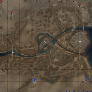
There are three Capture Points. (For AB and RB) Point A is in the town in the east, B is in the camp in the middle, and C is under the bridge in the west.
Conquest
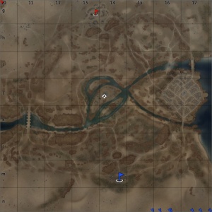
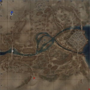
There are three configurations of the conquest mode, each with one capture point. The capture point will be in the position of one of the domination capture points.
Battle
There are two capture points, each owned by one of the teams. (For AB and RB) One point is in the camp in the cenre north of the map, and the other is in the small town in the centre south of the map.
Strategy
Media
References
Read also
Sources
Paste links to sources and external resources, such as:
- topic on the official game forum;
- other literature.


